WarViews
IMPORTANT NOTICE (Oct 2011)
Due to technical difficulties with the original WarViews setup, I no longer maintain the Geoserver used for the original WarViews service. Users can download KML versions of the WarViews datasets here
http://downloads.weidmann.ws/warviews/
The datasets open in Google Earth, and the temporal animation can be played. This legend describes the notation used in the KML files.
Description
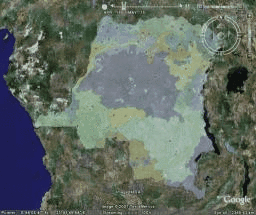
In recent years, the field of conflict research has produced important findings on the relation between conflict and geography. For this purpose, new datasets have been created with the help of GIS software. These datasets include variables relevant for the study of conflict with a spatial reference. However, the use of geographic data requires specialized software and some training and therefore involves high entry costs for researchers and practitioners. The aim of the WarViews project is to create an easy-to-use front-end for the exploration of GIS data on conflict. It takes advantage of the recent proliferation of internet-based geographic software and makes geographic data on conflict available for these tools. WarViews comes in two "flavors": The static version runs in a web browser and allows the user to switch between different datasets. The dynamic version is based on GoogleEarthTM and can animate geographic data such that the development over time can be monitored.
Collaborators
Doreen Kuse, Dresden Technical University
Further Information
Main WarViews page at the Center for Comparative and International Studies, ETH Zurich
WarViews article in International Studies Perspectives
GeoServer, an open-source GIS server used for WarViews
Google Earth, required to view the dynamic WarViews animation
OpenLayers, a web mapping toolkit used to create the static WarViews page
WarViews in the Media
GIS Business (April 2008)
Tagesanzeiger (January 2008)
ETH Life (December 2007)